Small Route Trail, PR-A267, Alfarnate, Axarquía, Málaga, Andalucía.
Distance: 11.2Km. Route: Roundtrip
Recommended season: All year, except summer
Start: Alfarnate (next to the municipal sports center)
End: Alfarnate (Entering by Pozo Rincón)
Classification: Physical difficulty: medium-high. Technical difficulty: medium
Approximate time on foot: 4 hours
Modality: ideal for walking.
Cartography: “Periana” national topographic map sheet 1039-II (34-85) scale 1: 25,000
Maximum height: 1,415m. Pico de Vilo (Sierra de En medio).
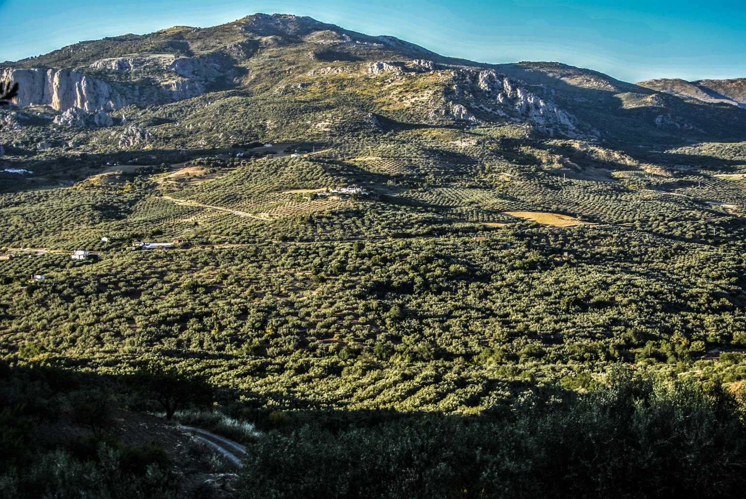
Main attractions: the excellent panoramic views of Alfarnate, the Sierra de San Jorge, Chamizo, Sierra de En Medio, Tajos del Fraile and Doña Ana and all the surroundings. And especially the 360-degree panoramic view from the top of the Pico de Vilo from where we can contemplate Sierra Nevada, the peak of the Maroma of the Natural Park of Sierra Tejeda, Alhama and Almijara, the Viñuela Reservoir and in the background the Mediterranean Sea, thus like several towns in the Axarquía, such as Periana, Colmenar, Alcaucín, Canillas de Aceituno, Comares ... The abundance of scrubland and a beautiful pine forest with some specimens of firs. The existence of a traditional construction of great value: an Era, which is located halfway towards the Pico de vilo, and which is built on the basis of large natural edges, local stone slabs embedded in the ground, unique in the zone.
Practical advice: bring binoculars and a camera to contemplate and photograph the excellent views. Wear comfortable shoes, preferably hiking boots.
Bring food and drink supplies, as there are no refreshment points throughout the tour.
Signage: Wooden beacons with white and yellow lines, also some stone markers made by hikers help us.
Description:
We start the tour next to the municipal sports center El Ejido, in the background on the right we find a small decoration, which was used to celebrate the Embassy of Moors and Christians. On the left there is a well-equipped camping and rest area with plenty of shade. We continue along a dirt track, for approximately 1 km. In the background on the right we can see excellent views of Alfarnate, surrounded by impressive mountains: Sierra de San Jorge, Tajo de la Palomera, Cerro del Castillejo.
The lane runs on stony, limestone terrain, finding almond, holm oak and other shrubs in the surroundings. On the way up the first slope we find a T.V repeater crowning the Morrón del Águila, (many people use this point as a starting area, so as not to make the lane on foot, leaving the car parked here). From this point you can see Alfarnate and Alfarnatejo. In front and on the left we will see the Jobo mountain range crowned by Pico de Chamizo, as well the little picks, Carrasco, Matagallar, El Torcal and El Cuartillo, just behind and above the town of Alfarnatejo.
From here we continue the ascent in the left direction through a path that borders the Morrón del Gallo (1,363 m). From here you can see the Tajos del Fraile, Gómer and Doña Ana on our right. When we have traveled a little more than 3 kilometers we find a fork that in the right lane leads to the Cortijo del Alguacil. We continue on the left towards a pine forest. The path narrows further on and we enter a path that leads us to the next point of reference: a beautiful Era with huge stones embedded in the ground. 100 meters higher we find a fence that we will get around without difficulty. We continue among pine trees and bushes along the widest path without losing sight of the metal fence to our right until we see a very stony and little vegetation that we will border on the left.
From the bell pepper we will begin the final ascent towards the Vilo peak. Once there, we start the journey back along the same itinerary but descending.
Brochure of the route, clicking here
.jpg)
.jpg)
.jpg)
.jpg)